Marine Geophysics &
Seabed Confidence

Locate seabed features, investigate shallow layers and map magnetic anomalies for routes, sites and marine works. We combine the sensors and interpretation needed to describe the conditions relevant to your project.

  • Side-scan, sub-bottom & magnetometer
  • UXO survey support & route investigations
  • Seabed hazards & routing

Two Ways to
Work With Us.

01

We run it

  • Side-scan, sub-bottom and magnetometer surveys for routes, sites and berths.
  • Mobilisation, calibration and deployment of the survey systems.
  • Documented sensor checks and system integration tests, including reference or target runs appropriate to the method and specified detection requirements.
  • Contact registers, interpreted profiles, seabed classification and maps.
  • Survey data to support your UXO specialist’s risk assessment and ALARP process.
02

We check it for you

  • Specification and line spacing reviewed against the required target detection and coverage.
  • Sensor checks, altitude, positioning and coverage reviewed during acquisition.
  • Contact picking and interpretation reviewed against the raw data and agreed deliverable requirements.
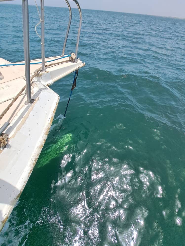
Side-scan towfish rigged at the bow of a partner launch, in shallow clear water off Senegal

A Setup Matched
to the Site.

On this nearshore scope in Senegal, a partner launch provided a practical survey platform. The towfish was rigged at the bow, clear of the propeller wash, in a few metres of water. The mounting and method were chosen for the depth and conditions of this site.

  • Sub-bottom profilingBoomer, sparker and chirp for shallow geology and burial assessment for cables and pipelines. Large UHRS campaigns: specified and followed on the client’s side.
  • pUXO target investigation, client-sideField experience as party chief on target-reduction campaigns. Technical support for specifications, contractor selection and review of survey results.
  • Wrecks and heritageSide-scan and magnetometer search, support to archaeology.
  • Seabed obstruction surveysLocate and map debris, boulders and other constraints before construction or anchoring.
  • Support to geotechnical campaignsSurvey positioning and station records for grabs, CPT and vibrocoring.

SEABED & SUBSEABED

SSS, SBP & MAG

Need to see obstacles or layers? Side-scan creates seabed imagery, sub-bottom profiling looks below the seabed, and magnetics helps identify ferrous targets and constraints.

Technical context

Experience includes EdgeTech, Klein, INNOMAR, Knudsen, ECHOES, Geometrics and SeaSpy systems, with acquisition, interpretation and data QA/QC workflows.

What you receive

  • Sonar mosaics & targetsGeoreferenced side-scan mosaics, contact registers, seabed interpretation and classification.
  • Magnetic & UXO mapsMagnetic anomaly maps and target registers for route studies, buried pipe and cable locating, and specialist UXO assessment.
  • Sub-bottom profilesGeoreferenced profiles, reflector interpretation and shallow-geology maps as specified.
  • GIS-ready data & reportsGeoreferenced layers, sensor and processing records, metadata and an interpretation report.

Start with the Scope.
We Build the Response.

Send us the problem, the site or the first brief. We will help define a practical way forward around the programme, constraints, local context and decision required.