Survey campaigns and onboard technical support for cable and pipeline projects, marine construction, ports and dredging. We mobilise the people, survey systems and positioning needed for your scope.
Pre-lay, as-laid and as-built survey campaigns, including as-found surveys of existing assets.
Mobilisation, calibration and deployment of survey systems aboard the project vessel.
Positioning for vessels, barges, tugs and structures, with surface GNSS, motion reference and USBL.
Spread telemetry and a tug management system (TMS): barge, tugs and anchors tracked live on one display.
Hydrographic and geophysical acquisition, survey logging and KP-referenced reports for your installation records.
02
Review third-party survey work
Mobilisation procedures and positioning configuration reviewed against the agreed specification.
GNSS checks and USBL, multibeam, gyro and motion-reference calibrations witnessed and reviewed against the survey requirements.
Survey and ROV survey records, coverage and deliverables reviewed against your specification for technical acceptance.
WGS provides the survey and positioning role: vessel navigation, installation and operational decisions remain with the appointed marine teams.
Typical assignments
Surface positioningPositions and tracks for survey vessels, barges, tugs and structures in the project reference systems.
Anchor-handling and tug supportPosition feeds, working routes and tracking displays agreed with the marine team.
Cable and pipeline campaignsRoute, pre-lay, as-laid and as-built surveys supporting cable and pipeline installation, burial and repair.
Rock placement and seabed preparationSurvey and positioning support for rock bags, mattresses, sleepers and route-clearance work.
USBL and ROV survey supportUSBL positioning of ROVs, divers and sensors, with survey interfaces for ROV-mounted multibeam and magnetometer data.
Survey mobilisationSensor mounting, calibration, power, timing, communications and data recording prepared for the vessel.
Shallow-water visual inspectionsLight camera inspections and visual reports for shallow-water assets.
In practice
POSITION & ATTITUDE
GNSS, INS & USBL
Where are the vessel, sensors and underwater targets? Surface GNSS, motion reference and USBL provide the positions needed to relate the survey to the project’s reference systems.
Technical context
Systems encountered include Trimble, Septentrio, Hemisphere, C-Nav, Applanix POS MV, SBG, Exail, Sonardyne, Kongsberg HiPAP and GAPS.
PIPELINES & CROSSINGS
As-Found & As-Laid Surveys
Where are the pipes, and how do they sit? We map exposed pipe sections, crossings and the surrounding seabed to support route planning and as-laid records. Buried sections require an appropriate detection method and positioning strategy.
Technical context
Multibeam point clouds can document top-of-pipe levels and visible spans where geometry and resolution permit. Sub-bottom or magnetic methods may be selected for buried lines, with depth of cover reported where the data support it.
Example scope
INFRASTRUCTURE
Cable, Pipeline & Marine Construction Surveys
Positioning, survey checks and records to support the marine works from preparation to handover.
Cables, pipelines, landfalls, ports and dredging
Hydrographic and geophysical investigations
Pre-lay, installation, as-laid and as-built survey continuity
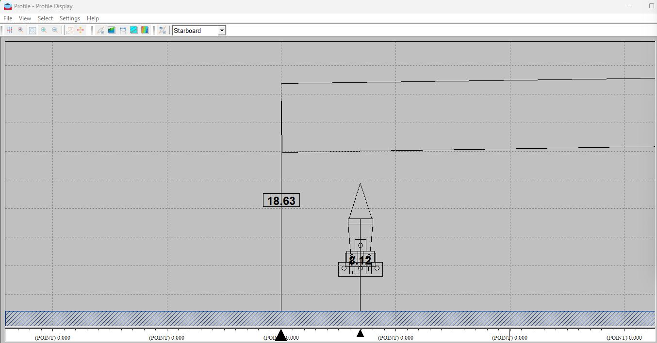
Artificial reef installation, monitored live. The module hangs from the crane: its offset from the target and its height above the seabed update on the profile view as it is lowered, until it lands on its set-out position (QINSy profile view).
What you receive
3D terrain modelsGridded DTMs, point clouds and volume computations.
Sonar mosaics & targetsSide-scan mosaics, contact lists and seabed classification.
Positioning & event recordsTime-stamped vessel and sensor tracks, configuration records, quality checks and event logs.
Route, as-laid & as-built informationKP-referenced plans, profiles, observed features and installation records.
GIS & SSDM datasetsStructured layers, attributes, metadata and project data in GIS and SSDM formats.
Reports & data handoverProgress and final reports, documented survey results and a clear delivery package.
Send us the problem, the site or the first brief. We will help define a practical way
forward around the programme, constraints, local context and decision required.